


 6 Terms
Home > Terms > English, UK (UE) > Jesusland Map
Jesusland Map
An Internet meme, created shortly after the 2004 United States Presidential election, which satirises the red/blue states scheme by dividing the United States and Canada into either "The United States of Liberty & Education" or "The United States of Canada," and "Jesusland". The meme is in the form of a map of the U.S. and Canada which depicts a new hypothetical national border between the two countries.
This is auto-generated content. You can help to improve it.
0
0
Improve it
- Part of Speech: proper noun
- Synonym(s):
- Blossary:
- Industry/Domain: Internet
- Category: Internet memes
- Company:
- Product:
- Acronym-Abbreviation:
Other Languages:
Member comments
Terms in the News
Featured Terms
Industry/Domain: Geography Category: Cities & towns
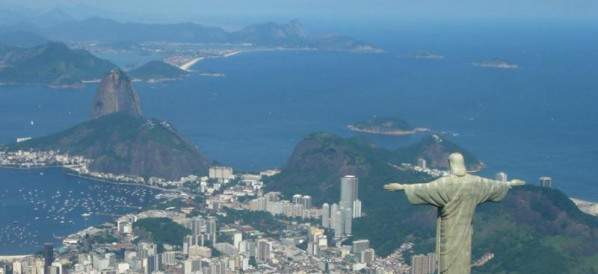
rio de janeiro
Rio de Janeiro is the capital city of the State of Rio de Janeiro and the second largest city in Brazil. "Rio"; which the city is commonly ...
Contributor
Featured blossaries


Browers Terms By Category
- Rice science(2869)
- Genetic engineering(2618)
- General agriculture(2596)
- Agricultural programs & laws(1482)
- Animal feed(538)
- Dairy science(179)
Agriculture(10727) Terms
- Social media(480)
- Internet(195)
- Search engines(29)
- Online games(22)
- Ecommerce(21)
- SEO(8)
Online services(770) Terms
- General art history(577)
- Visual arts(575)
- Renaissance(22)
Art history(1174) Terms
- Aeronautics(5992)
- Air traffic control(1257)
- Airport(1242)
- Aircraft(949)
- Aircraft maintenance(888)
- Powerplant(616)
Aviation(12294) Terms
- Film titles(41)
- Film studies(26)
- Filmmaking(17)
- Film types(13)