 6 Terms
Home > Terms > English, UK (UE) > Spatial data
Spatial data
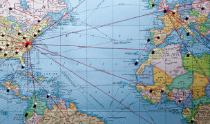
Data that is represented as 2D or 3D images. A geographic information system (GIS) is one of the primary applications of spatial data (land maps).
Other Languages:
Member comments
Terms in the News
Featured Terms
phylum placozoa
Macroscopic, flattened marine animals, composed of ventral and dorsal epithelial layers enclosing ...
phylum cnidaria
Cnidarians. Hydras, hydroids, jellyfish, sea anemones, and corals. Free-swimming or sessile, with ...
share a term with millions
Share a term with millions of users around the world and increase your online visibility.Share a ...
oak
Genus native to the Northern Hemisphere with spirally arranged leaves, catkins for flowers and ...
Everest
The last but not least mount Everest. The Earth's highest mountain, with a peak at 8,848 metres ...
aglaonema
Genus of about 20 species of usually rhizomatous, evergreen perennials from tropical forest in Asia. ...
Robojelly
Robojelly is a hydrogen-powered robot desgined in the United States that moves through the water ...
Ferdinand Porsche
Ferdinand Porsche (3 September 1875 – 30 January 1951) was an Austrian-German automotive engineer ...
Marzieh Afkham
Marzieh Afkham, who is the country’s first foreign ministry spokeswoman, will head a mission in east ...
define1
Share a term with millions of users around the world and increase your online visibility.Share a ...
Contributor
Featured blossaries
Browers Terms By Category
- Ballroom(285)
- Belly dance(108)
- Cheerleading(101)
- Choreography(79)
- Historical dance(53)
- African-American(50)
Dance(760) Terms
- Investment banking(1768)
- Personal banking(1136)
- General banking(390)
- Mergers & acquisitions(316)
- Mortgage(171)
- Initial public offering(137)
Banking(4013) Terms
- General jewelry(850)
- Style, cut & fit(291)
- Brands & labels(85)
- General fashion(45)
Fashion(1271) Terms
- Skin care(179)
- Cosmetic surgery(114)
- Hair style(61)
- Breast implant(58)
- Cosmetic products(5)
Beauty(417) Terms
- Natural gas(4949)
- Coal(2541)
- Petrol(2335)
- Energy efficiency(1411)
- Nuclear energy(565)
- Energy trade(526)


